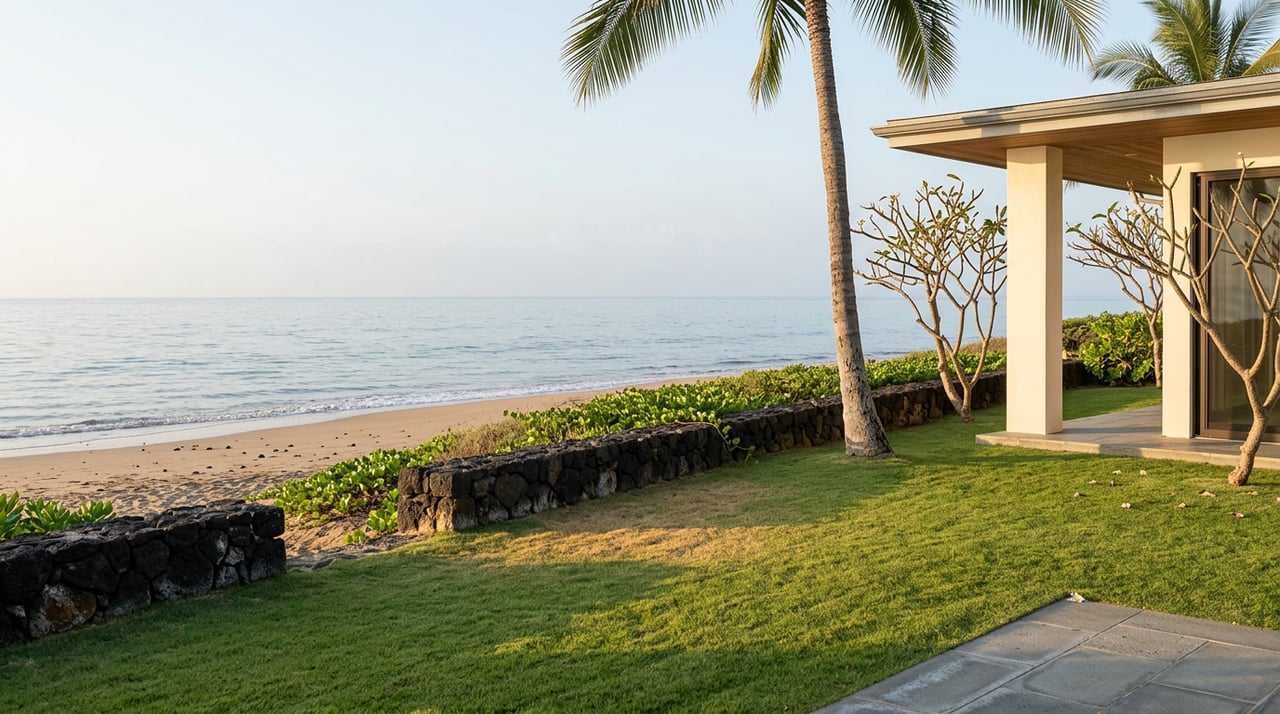
Behind 4623 Kahala Avenue this summer, an exposed sewer cover sits in the sand next to a swimming pool wall the tide has undercut down to the rebar. A rusted chainlink fence a few doors down at 4607 is expected to fail before the next big swell moves it for good. These aren't old storm-damage photos. The Honolulu Star-Advertiser documented both scenes in reporting published in late June and early July 2026, part of a wider pattern of state enforcement that has now reached at least eight oceanfront addresses along Kahala's famous 4600 block, with notices issued between February and May 2026.
For a street that regularly produces some of the highest home prices in the state, shoreline questions can matter even when reported conditions have nothing to do with a particular lot. Sellers can focus on the records and requirements relevant to their own property.
What the State Is Actually Citing
The Department of Land and Natural Resources isn't citing homeowners for having an eroding beach behind their house. Erosion itself isn't illegal. What DLNR has flagged is a specific list of obstructions on public sand: a pool wall, sections of fencing, concrete rubble, buried irrigation pipe, and vegetation that used to sit safely on private land and now sits on what the law defines as the beach. At 4623 Kahala Avenue, the landowner, Asagami Corp, has owned the property since 1989, and DLNR's enforcement file on that same stretch of pool wall and fencing goes back to at least August 2005, with another notice sent as recently as August 2024. A few blocks away at 4615 Kahala Avenue, a prior owner was cited in 2015, 2018, and 2021 over the same temporary erosion barriers DLNR had originally approved back in 2009. The Garden Island reports that penalties for non-compliance can run as high as $15,000 a day. The agency has said it expects the harder cases to require more than a fence repair to resolve.
That distinction matters for anyone thinking about listing nearby. DLNR's enforcement records document the location of specific structures relative to a shoreline that moves. Two lots on the same block can be in very different positions depending on how their prior owners built, and whether they've kept up with the paper trail.
Why One Owner's Seawall Becomes the Next Owner's Problem
The mechanism driving this isn't a mystery to coastal engineers, even if it surprises buyers. When one property armors its shoreline with a wall or rock revetment, the wave energy that used to dissipate across that stretch of sand gets redirected toward the neighboring, unarmored lots. Erosion accelerates next door. That neighbor then has an incentive to harden their own shoreline too, and the problem migrates down the beach one property at a time. A coastal expert quoted in the Star-Advertiser's reporting, identified as Foley, described the broader ecological version of this same feedback: disrupted dunes degrade the reef, degraded reefs remove a natural buffer, and the erosion gets worse from there.
"It creates a negative feedback cycle," Foley said. "I think we're stuck in that cycle right now."
A follow-up column in the paper made the same point from a different angle: Hawaii's legal shoreline is defined as the upper reach of wave wash, which means it moves landward as sand disappears, and every foot an owner tries to hold in place by force is a foot of public beach that stops functioning as public beach. That's the argument driving the current enforcement wave, and it's not going away because one owner installs sandbags.
Honolulu's Shoreline Setback
For future building plans, the certified shoreline is the reference point for Honolulu's setback.
Honolulu's own ordinance spells out how that line gets drawn: the default shoreline setback runs 60 feet inland from the certified shoreline where no historical erosion data exists, though a director can adjust that line down to a minimum of 40 feet to preserve a workable building envelope on an undersized lot.
Documents Sellers Can Gather Before Listing
These records may come up during a buyer's due diligence. Sellers can assemble a file of relevant documents before listing so buyers can review them during the transaction.
That file should include:
- A current certified shoreline survey, not an assumption based on where the fence line has always been.
- Copies of any DLNR correspondence for the property, along with documentation of whatever was corrected and when.
- A written determination of the applicable shoreline setback for that specific lot.
The relevant records will vary by property, so this list is a starting point for organizing the file.
Kahala Avenue Market Conditions
None of this has cooled demand for the address. As of April 2026, Waialae-Kahala carried the highest median single-family sale price of any Oahu micro-market, with homes moving in a median of roughly eight days once they were priced and presented correctly. That's a sharper contrast than it looks at first glance: elsewhere in East Honolulu's luxury single-family segment, a March 2026 market report tracked days on market stretching past 100 as buyers became more selective and price reductions became more common. The figures cover different months and market segments.
The ceiling for the street hasn't moved either. Just last year, a Kahala Avenue estate known as Hale Hanohano sold for $65.75 million, setting a new record for any residential sale in Hawaii. Buyers at every price point on this street are still willing to pay for the address. What's changed in 2026 is how closely they're now willing to look at what they're actually buying.
FAQ
Does the DLNR enforcement affect every home on Kahala Avenue equally? No. It's tied to the specific location of structures relative to a shoreline that has moved inland over time, which varies lot by lot depending on how far back a home was originally built and what, if anything, sits between it and the current wave wash.
What if a property already has a DLNR notice on file? A notice with documented resolution is a very different story than an open, unresolved one. Sellers in either position are better served by addressing it before listing, since a resolved file removes the uncertainty a buyer would otherwise have to investigate themselves.
Does an active erosion story near a property mean it should be priced lower? Not automatically. The relevant question is where that specific structure sits relative to the certified shoreline and what shoreline requirements apply, not whether erosion has made headlines nearby.
Should an owner wait to see how the current dune restoration project performs before listing? That depends on the individual lot and its own DLNR history. It's a conversation worth having with a local agent who can pull the specific shoreline survey and compliance record for that address before deciding on timing.
Kahala Avenue rewards sellers who show up with answers instead of hoping the questions don't come up. If you're weighing a sale on this street, or trying to understand what a specific shoreline position actually means for your options, Tracy Allen can walk through the documentation with you before it becomes someone else's leverage. Book an appointment to start that conversation.
This article is general information, not legal, tax or financial advice. Consult a qualified professional about your situation.